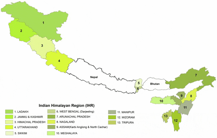


IHR- The Target Area
The Indian Himalayan Region – The Target Area
With geographical coverage of over 0.53 million km2 area, the Indian Himalayan Region (IHR) constitutes nearly 17% of country’s geographical area and contributes greatly to richness and representativeness of its biodiversity components at all levels (i.e., genes, species and ecosystems). Although the region represents only about 4% of total human population of the country, it exhibits great diversity of ethnic groups (e.g., 171 out of a total 573 reported scheduled tribes in India), often inhabiting remote and inhospitable terrains. The diversity of biophysical features in IHR is adequately represented through representation of 3 bio-geographical zones and 9 bio-geographic provinces (Table).
| Table: Diversity of biophysical features in IHR | |||
| Bio-geographic Zones | Bio-geographic Provinces | % of geographical area of India | Major Biome Representation |
| Trans Himalaya | 1A: Ladakh Mountains | 3.3 | Tundra |
| 1B: Tibetan Plateau | 2.3 | Alpine | |
| 1 C: Sikkim Trans Himalaya | < 0.1 | Alpine, Tundra | |
| The Himalaya | 2A: North west Himalaya | 2.1 | Alpine, Temperate, Sub Tropical |
| 2B: West Himalaya | 1.6 | -do- | |
| 2C: Central Himalaya | 0.2 | -do- | |
| 2D: East Himalaya | 2.5 | -do- | |
| Northeast India | 9A: Brahamputra Valley | 2.0 | Tropical Evergreen Forest, Very Moist Sal Forest, Tropical Grass Lands |
| 9B: Northeast Hills | 3.2 | Tropical evergreen, Tropical Moist Deciduous, Subtropical, Montane Temperate, Wetlands | |
| Source: Rodgers and Panwar, 1988; Rodgers et al., 2000 (Wildlife Institute of India). | |||